網站開關 検索
搜尋
近くのトラベル情報
観光の名所
宿泊情報
飲食
ショップ
ビジターセンター

浦来渓頭社戦道

推薦: 推薦
六亀区

Clear(六亀区)

32

Googleレビュー
4.4
103件のクチコミ
この文字をクリックして、キーボード操作によるアルバム機能の説明を見る:
  • アップキー:写真選択を表示
  • ダウンキー:写真選択を非表示
  • レフトキー:前の写真
  • ライトキー:次の写真へ
  • ESCキー:アルバムを閉じる
  • 浦来渓頭社戦道-1 浦来渓頭社戦道-2 浦来渓頭社戦道-3 浦来渓頭社戦道-4 浦来渓頭社戦道-5

    浦来渓頭社戦道

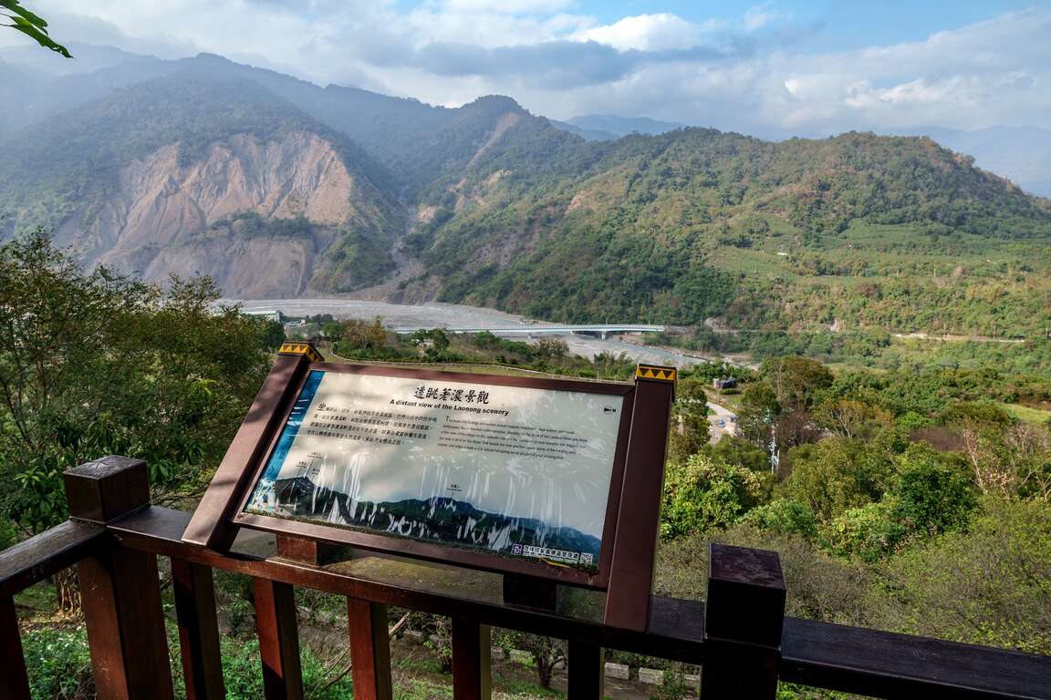
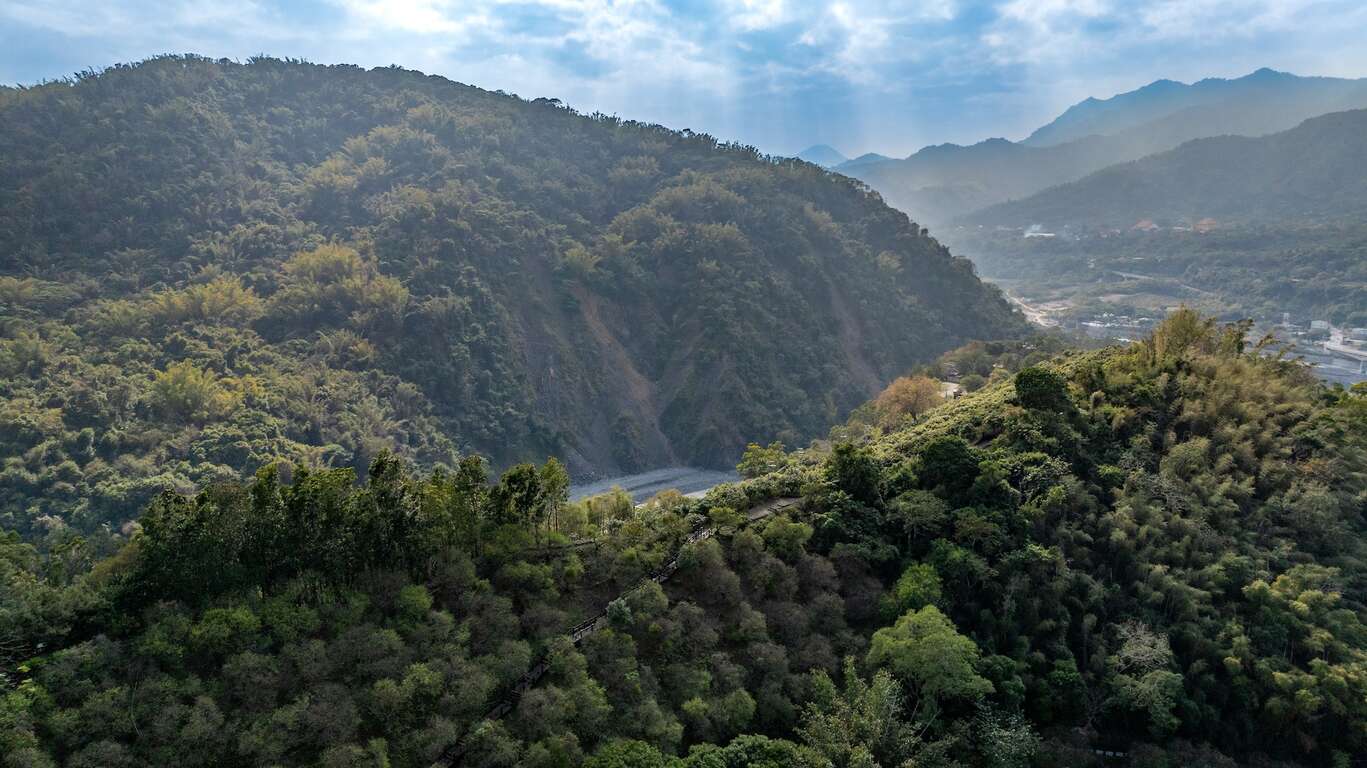
高雄市六亀区の宝来花賞公園内に浦来溪頭社戦道の入り口はあります。「浦来」とは宝来の古い呼び名で、浦来溪頭社(原住民の集落があった場所)は、荖濃川と宝来川のふたつの河川の分水嶺に位置しています。20世紀初頭、日本の人類学者が「浦来溪頭社」の遺跡をこの地で発見しました。かつて日本統治時代に、原住民の激しい抗日運動を抑えるべく、美瓏山に砲台が建造されました。その時必要な建材を宝来の峰の頂まで運ぶために、美瓏山の稜線に沿って敷かれた道路が浦来渓頭社戦道の前身で、歴史的に大変重要な意味を持っています。

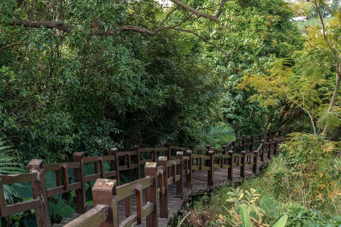
浦来渓頭社戦道は全長がおよそ3キロです。当時の面影を残すように自然の工法を採用し整えられており、道沿いでは竹林、アカシア林、タイム、梅園など、様々な植物の生態を見ることができます。お薦めの滞在時間は約1時間です。 

旅行情報
旅行タイプ

ハイキング郊外へ散策歴史古蹟

このような一説もある

「戦道」の由来は日本統治時代、日本による統治を甘受しない原住民族の人々を抑えるためのものでした。台湾総督府は原住民族の抗日の動きを知ると、浦来渓頭社の村人たちに圧力を与えるため、稜線に沿って弾薬や大砲などの武器を運ばせ、向かいの美輪山に砲台を建設しました。日本人は夜にこれらの武器を運んだため、人々が知らない間に浦来渓頭社への道は軍用道路となっていたのです。また、原住民族もこの軍用道路を通って日本軍を突撃しました。

住所

高雄市六亀区

电话番号

886-7-6871234

交通

車:
1. 旗山から台21号線を北上し甲仙まで進み、省道台20号線を曲がって宝来へ。
2. 国道10号線高速道路を旗山インターチェンジで下り、省道台28号線を進み、旗山と美濃を通過した後、省道台27甲線を進み、六亀を通過し、再び省道台27号線に接続、省道台20号線81キロ地点で曲がり宝来へ。

公共交通機関:高雄客運の「宝来」バス停下車

  • 経度/緯度:120.70149/23.10642
  • 付近の散策

    浦来渓頭社戦道
    4.4 4つ星 103件のクチコミ
    鄭琨寶
    4つ星 8 months ago

    #Kaohsiung# Six turtles# Pulai Xitou Society Battle Road The name of the trail comes from the discovery of the ruins of "Pulai Xitou She" by Japanese anthropologists during the Japanese occupation period. Pulai is the old name of Baolai, and Xitou She is located at the watershed between Yanong River and Baolai River. It was a settlement of the Tsou people a long time ago. . This battle route is said to have been built during the Japanese occupation. , The purpose is to build the Meilong Mountain Fort to control the activities of the local aborigines. The battle road is built along the ridgeline of the Meilong Mountain, and the coolies are mobilized to pull the gun barrels and building materials to the top of the Baolai Peak, which is of historical significance. . At present, the entrance of this trail is located in Baolai Huashang Hot Spring Park. It is about 3.5km back and forth. There is a slight climb but not very steep. Quite spectacular and perfect for a visit. . There is a viewing point in the battle road, and you can see the big collapsed wall next to the Baolai settlement, which is only separated by an Anonong River. 50m, the disaster also interrupted the Nanheng Highway, and the prosperity of the Baolai Hot Spring Area fell to the bottom of the valley. . In the past 13 years, this large collapsed wall is still barren. Every year during the flood season, the heavy rain still carries a large amount of soil and rocks to the riverbed, which continues to threaten the safety of the residents. The most recent serious disaster was the heavy rain in August last year. Baolai No. 1 Bridge, the only external road in the above area, has been closed for warning and turned into an isolated island on the road. Recently, the new Baolai No. 1 Bridge has been completed. The new bridge reduces the piers of the river and raises the bridge deck, so that there is more abundant water passage under the bridge. Should be able to face increasingly extreme climates.

    黃松合
    4つ星 7 months ago

    The wooden plank road is very new and easy to walk; there are mainly bamboo forests on both sides of the trail, and there are tree shades; the trail is up and down, and the slope is not very steep, but it may be a bit difficult for the elderly; the trail is not very long, if you are afraid of walking If you don't move, you can refer to the map and decide the route you want to take. On the way, you can overlook Baolai Stream and Yanong Stream.

    朱祤嘉
    4つ星 5 months ago

    There are many stairs at the first entrance, and the rest are very gentle and easy to walk.

    WunKai Wang
    5つ星 7 months ago

    A few-hundred-meter trail where you can overlook the township from, don’t miss it when you were here.

    Tsai Dustin
    4つ星 5 years ago

    Not bad

    最終更新日時:2022-07-14

    サイトマップ
    リストを開く
    リストを閉じる
    前のページへ トップページへ