Move to Main Content

Pulai Stream Xitoushe War Road

Recommend: Recommend
Liouguei District

Clear(Liouguei District)

26

Read the following for how to use your keyboard to browse the album:
  • Up:Show photo menu
  • Down:Hide photo menu
  • Left:Last photo
  • Right:Next photo
  • ESC:Leave album
  • Pulai Stream Xitoushe War Road-1 Pulai Stream Xitoushe War Road-2 Pulai Stream Xitoushe War Road-3 Pulai Stream Xitoushe War Road-4 Pulai Stream Xitoushe War Road-5

    Pulai Stream Xitoushe War Road

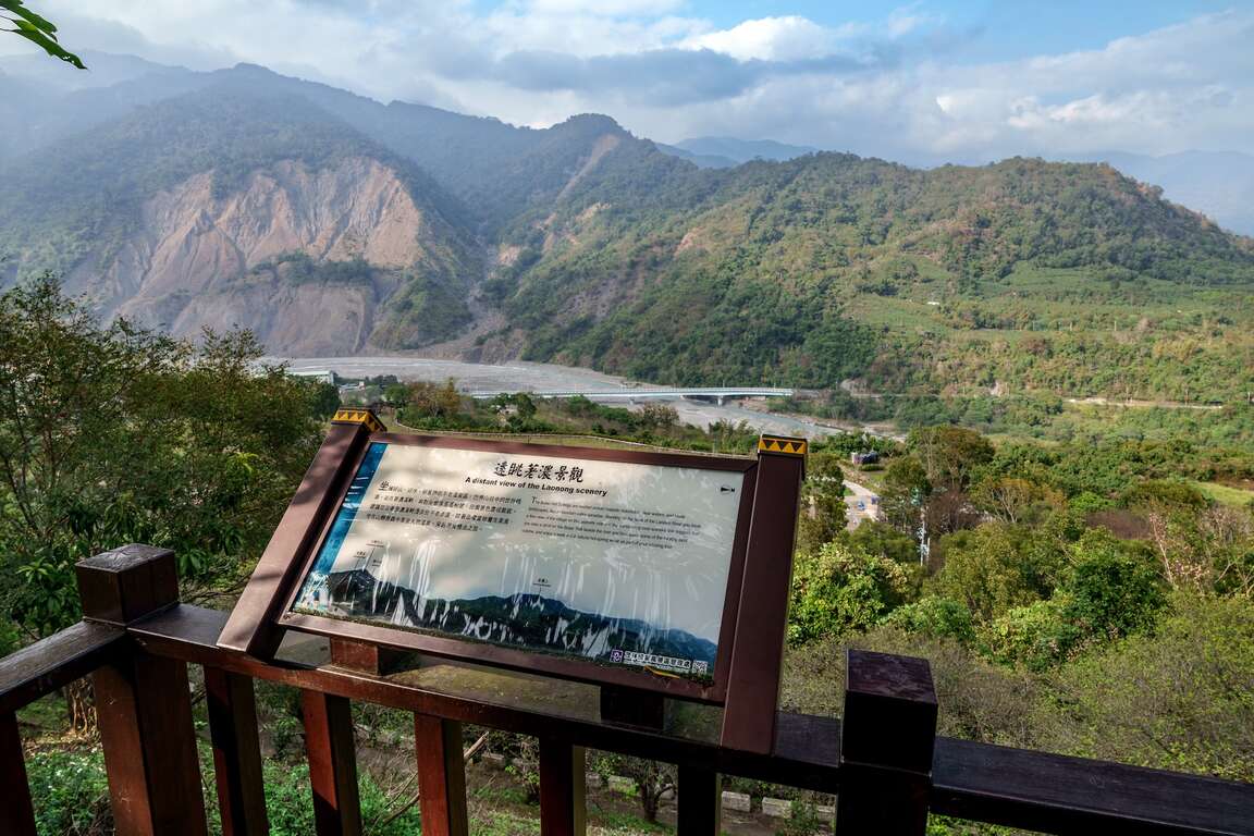
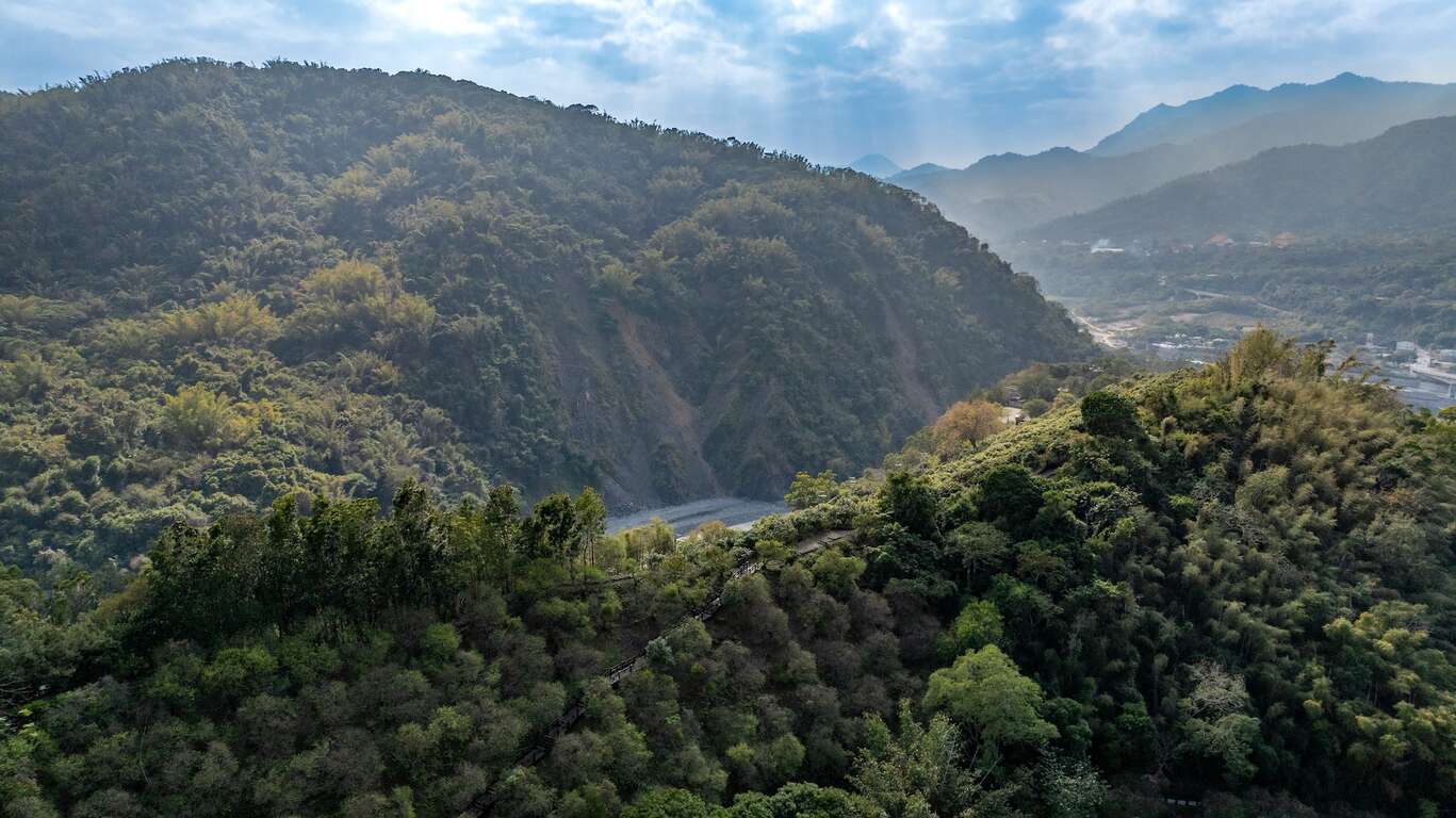
The trail entrance can be found in the Baolai Hot Spring Park in Liugui District of Kaohsiung. The trail is the namesake of the Pulai Xitou Tribe that found itself situated at the watershed separating the Laonong River and the Baolai River. At the beginning of the 20th century, a Japanese anthropologist came across the relics of the Tribe, which also included the battlefield trail. The trail was built circling up the Meilong Hill to transport construction materials for a fort on the top in the Japanese colonial era, which was used to regulate the indigenous activities. The trail then became known as the Pulai Xitou Tribe Battle Field Trail now, serving as a reminder of history.

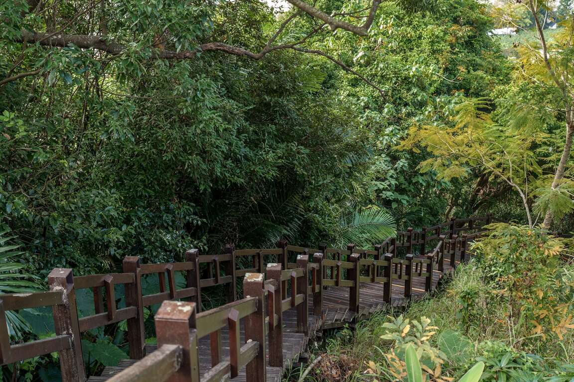
Visitors are recommended to spend an hour here. The trail is three kilometers long, and the pristine environment alongside is protected with ecological engineering methods. Said methods help to preserve a wide variety of plants on the two sides of the trail, including bamboos, Acacia confusas, Thymes, and plums. 

Travel info
Travel type

HikingOutingHistorical sites

There’s a saying that

The war road was built because during the early Japanese Colonial Period, the aborigines attempted to resist the Japanese people. The Japanese people came up with an intelligent idea and transported ammunition, mortars, and other weapons along the ridge at night, turning the path that was originally used by the aborigines into a military road. They also built a gun emplacement on Meilun Mountain opposite Xitoushe in preparation for an attack. However, the aborigines still tried to ambush the Japanese people along this road.

Address

Liugui Dist., Kaohsiung City

Tel

886-7-6871234

Traffic Information

Driving:
1. Travel along the Provincial Highway 21 North from Qishan to Jiaxian, then take Provincial Highway 20 to Baolai.
2. Take National Freeway 10 and exit to Qishan interchange, then take Provincial Highway 28 through Qishan and Meinong. Next, take Provincial Highway 27A through Liugui and connect onto Provincial Highway 27. Finally, take Provincial Highway 20 to Baolai, which is located at the 87km marker on the freeway.

Public transport: Take a Kaoshiung Transportation Co. bus to Baolai.

  • Longitude/Latitude:120.70149/23.10642
  • Nearby places

    Last Update:2023-10-25

    Sitemap
    Unfold Menu
    Close Menu
    Nearby Travel Info