Lovers' Gorge
Updated:2026-03-23
 3.9
3.9Popularity
20229- sight seeing and outings
Notice: The Lover's Gorge Trail and Lovers' Gorge Suspension Bridge are currently closed due to severe damage caused by Typhoon Kemi in 2025. The reopening date will be announced separately after repairs by the Kaohsiung City Maolin District Office are completed.
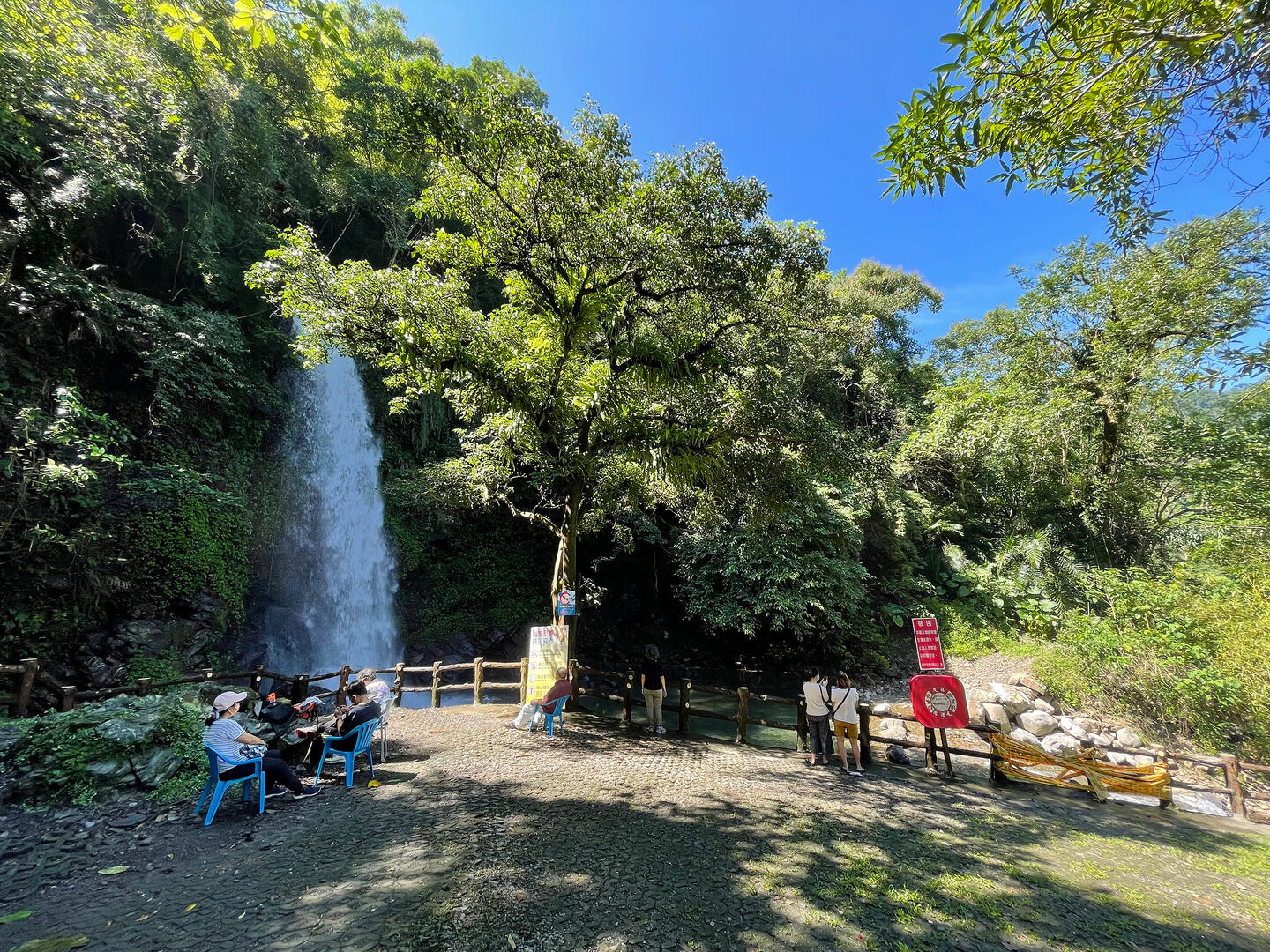
The Lovers' Valley, or Tubalu in the indigenous Lukai language, can be found on the Lovers' Valley Interconnected Highway. The valley has a clear and gentle stream at the flat river bed characterized by smooth sand.
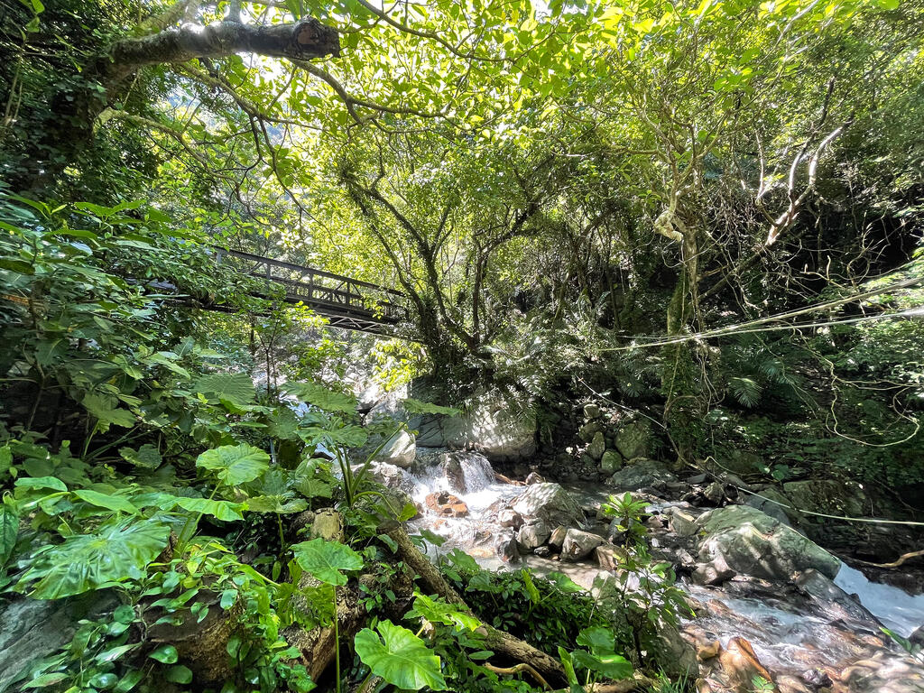
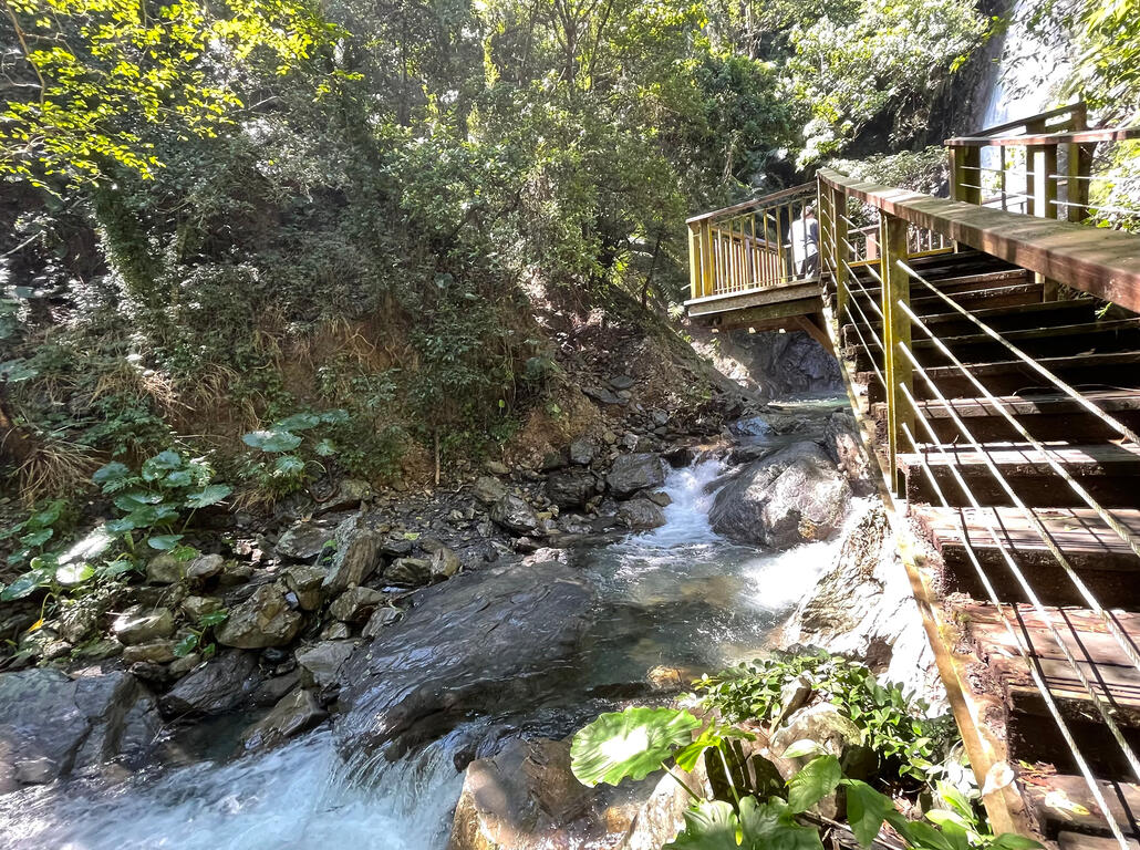
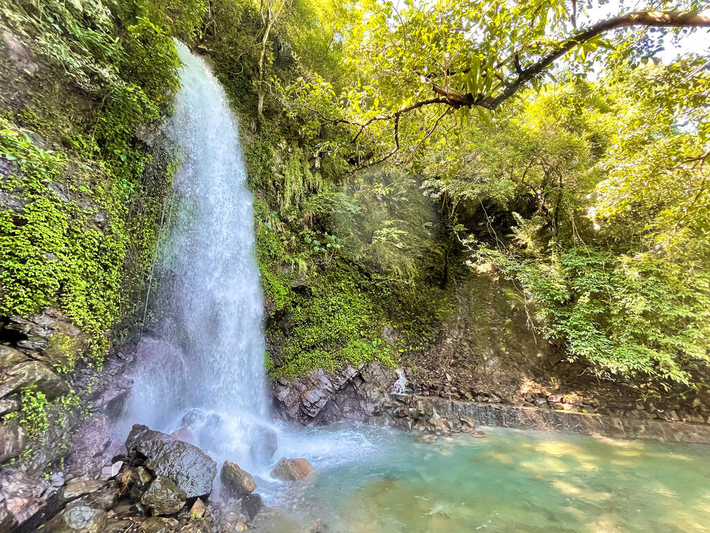
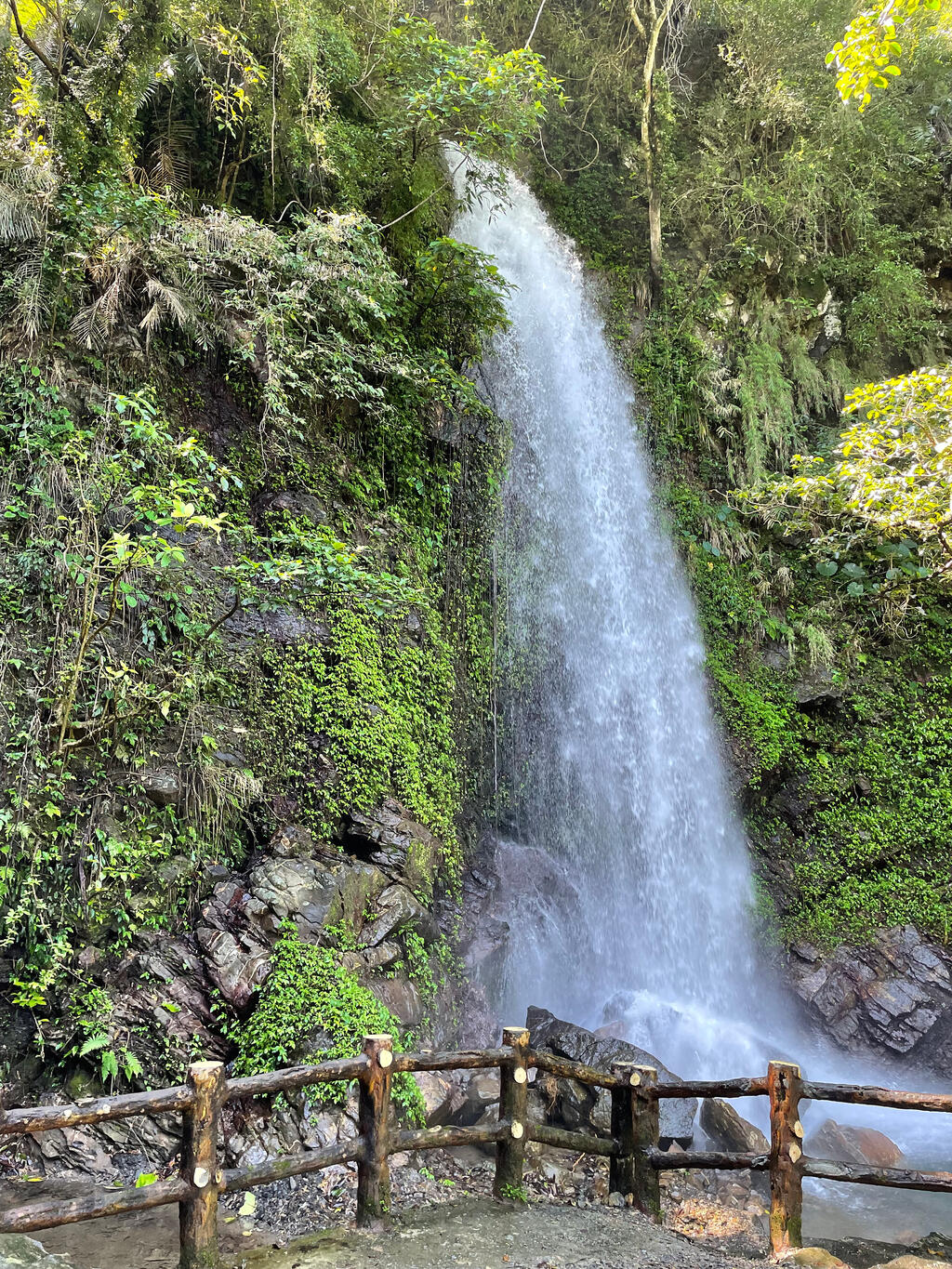
Upon arrival at the valley, visitors will see the Lovers' Valley Suspension Bridge, which spans across the Zhuokou River. After crossing the bridge, visitors only have to walk alongside a trail for another ten minutes to reach the Lovers' Valley Waterfall, which consists of five smaller waterfalls. However, visitors can only access the first and the second ones through a stairway beside the trail.
The Lovers' Valley is a great place to visit during summer if you want to hide away from the summer heat. You can appreciate the lush forest, surrounding mountains, and the melody of gurgling water while absorbing Phytoncide at a pavilion right beside the waterfall.
Visitors are recommended to spend around an hour here. Besides a stroll on the hiking trail, they can also relax by the waterfall or take pictures at the pavilion or on the suspension bridge.
After reaching the top of the stairs and walking for a distance, visitors will arrive at the Rainbow Falls, which is named for the rainbow created from the refraction of sunshine on water particles splashing at the waterfall during noon on a good weather day. The rainbow normally lasts for a few hours, and is said to resemble a silk cloth woven by fairies.
Information
Open Time
Temporarily closed
TEL
886-7-6801111
How to Get There