Timur Park
Updated:2026-03-23
 4.1
4.1Popularity
12276- aboriginal people homeland culture
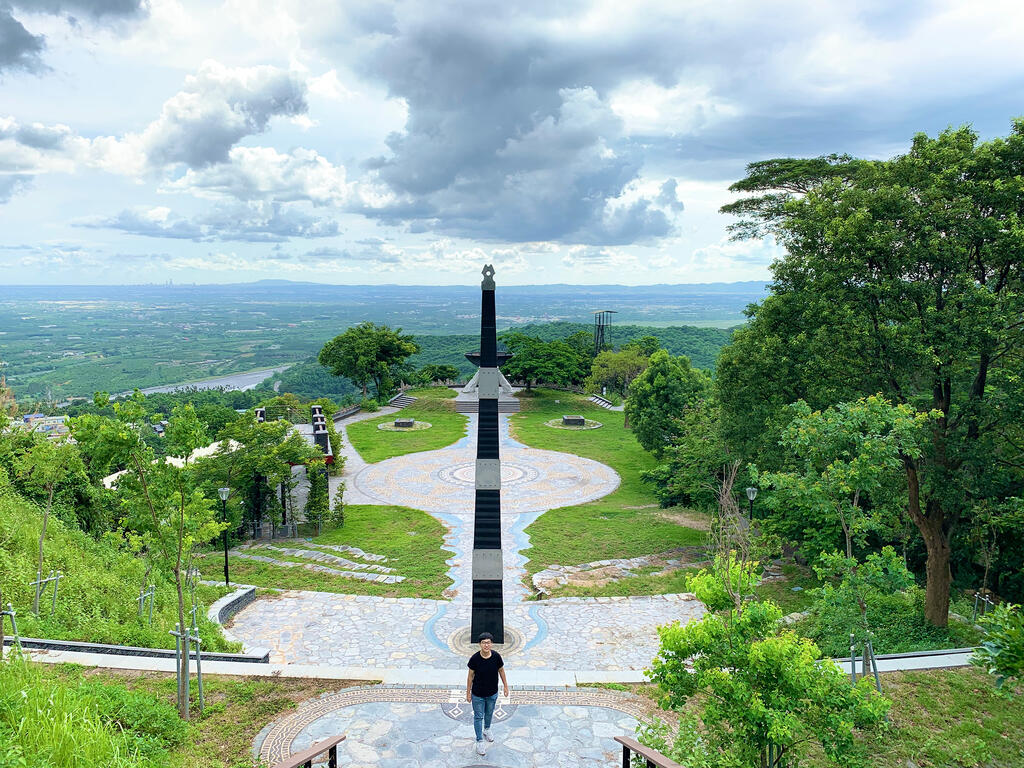
The Timur Park is situated 200 meters above the Sandimen Township Office. Timur means "people of the sun" in the Paiwan language and is the indigenous name for the Sandi Village.
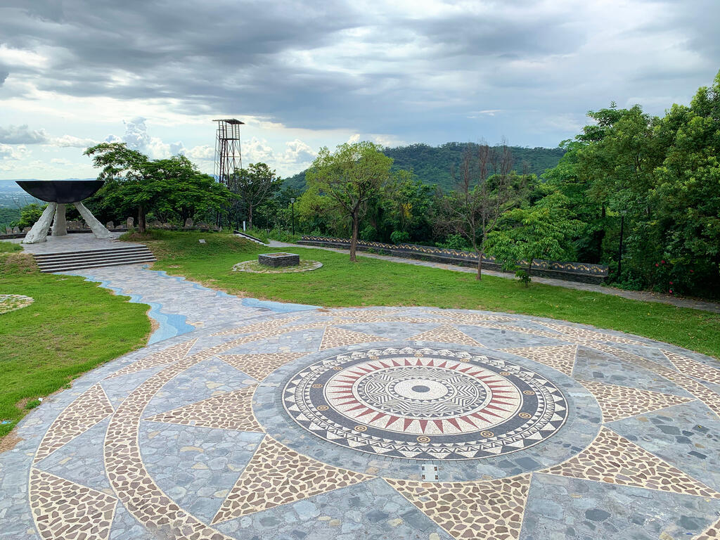
The park attracts tourists with its landmarks, the Theater of Life, and the Totem and Hearth of the Ancient.
The Theater of Life is a venue for various indigenous celebrations and ceremonies. The theater features rows of stone seats arranged in the shape of Deinagkistrodon, the reincarnation of the ancient in the indigenous Paiwan legend.
The Totem and Hearth of the Ancient symbolize two different characteristics in the indigenous culture. While the Totem symbolizes masculinity and inheritance, the hearth represents femininity, the continuance of life, and abundant food.
The park is also where various indigenous events are held, including the Harvest Festival of the Paiwan Tribe, wedding ceremonies of Austronesian Tribes, the Tung Blossom Festival, and other local celebrations. When the park is not busy, it can also be an ideal destination for those who wish to enjoy a relaxing stroll or sunset.
Visitors are recommended to spend 30 to 40 minutes here to look at landmarks mentioned above. They can also head over to the observatory to gaze at the surrounding mountains or take in the full view of Sandimen Township.
Information
Open Time
- Sunday:Open 24 hours a day
- Monday:Open 24 hours a day
- Tuesday:Open 24 hours a day
- Wednesday:Open 24 hours a day
- Thursday:Open 24 hours a day
- Friday:Open 24 hours a day
- Saturday:Open 24 hours a day
TEL
886-8-7997245
Remind
There are several extremely narrow paths in the mountain which are considered the tracks of mountain boars. Hunters often set traps to prey. Be mindful when passing through the paths.
How to Get There