Qingye Village
Updated:2025-03-24
Popularity
8825- aboriginal people homeland culture
Fun activities
- Dajin Waterfall is nearby. Lanzhu Garden guesthouse and café are close as well. Pay a visit when you are around.
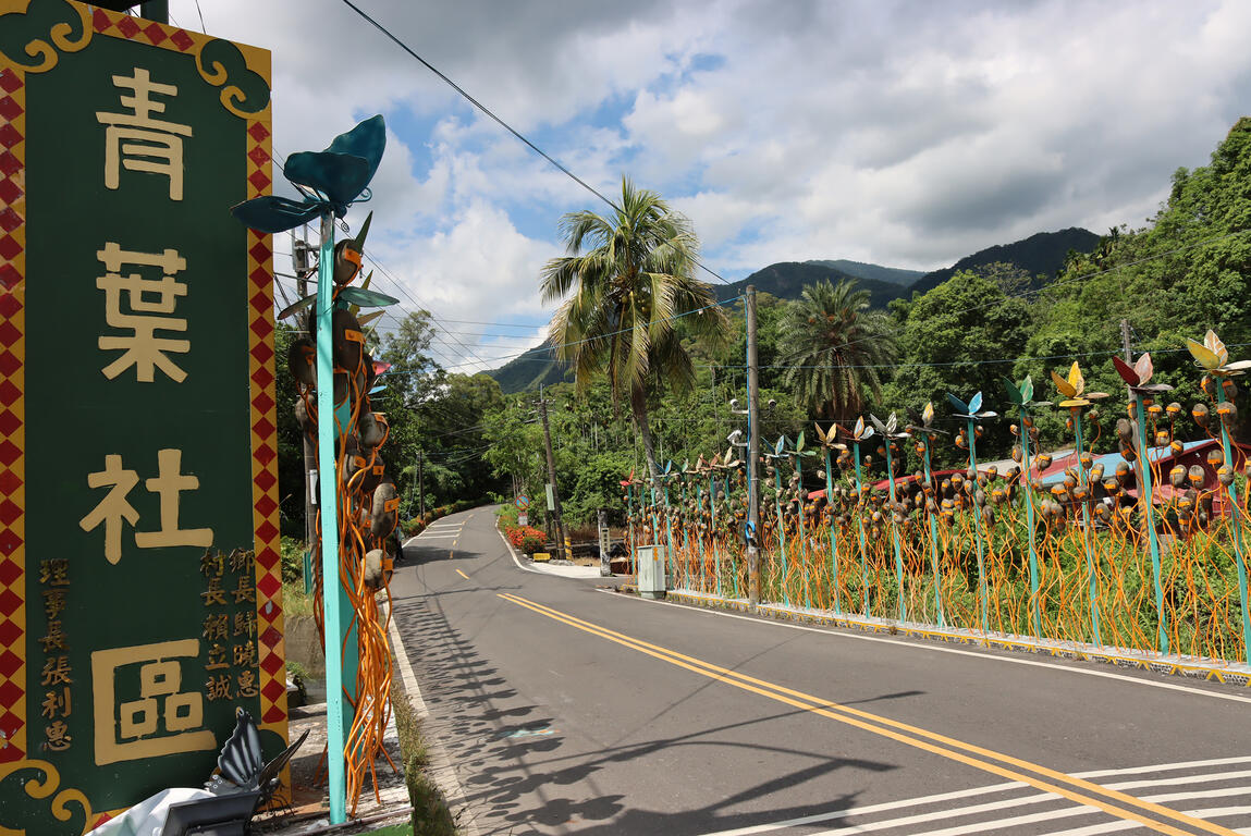
Qingye Tribe is a beautiful Lukai community on Pingtung County Highway No. 185. Its entrance is decorated with river rocks and images of butterflies, which also serve as the border of the tribe.
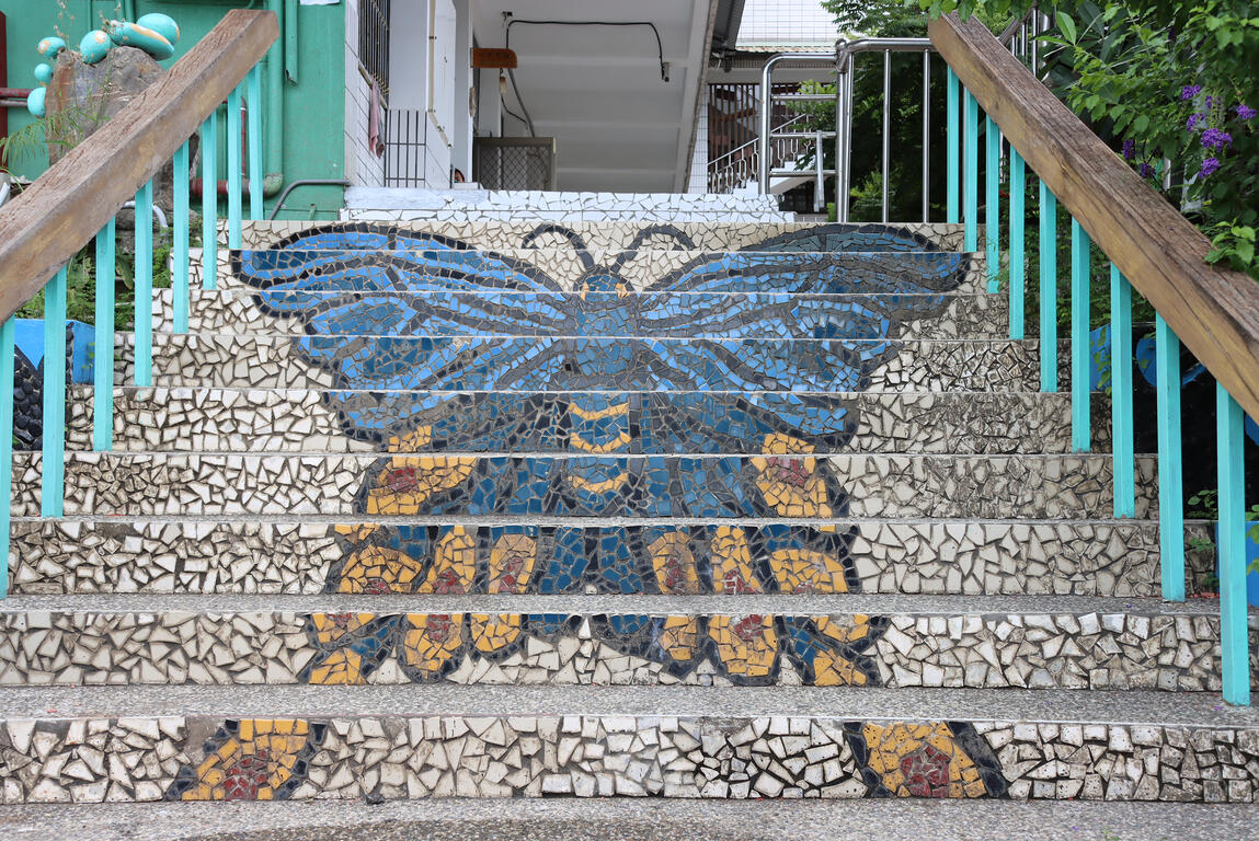
It is said that the tribe had been moving around four centuries ago before finally settling down at the current location in 1940. The village was transformed thanks to the young people of the tribe, who were inspired by their ancestors' stories and painted them on the walls of their houses, creating a colorful indigenous community. Among the young was a female artist who built a butterfly-shaped window and painted a butterfly wall, drawing much attention. The butterfly theme even extends into Qingye Elementary School, which features a butterfly staircase, serving as its connection with the broader tribe. Wandering around in Qingye Tribe is similar to visiting an outdoor museum, in which every household tells their stories through art painted on fences.
Visitors are recommended to spend two to three hours exploring the tribal ground. They can even hire tour guides from the local community development association to know more about the tribe and appreciate its beauty.
Information
TEL
886-8-7965667
How to Get There