Xinwei Forest Park

Recommend: Recommend
Liouguei District

Clear(Liouguei District)

24

Google Reviews
4.4
535 reviews
Read the following for how to use your keyboard to browse the album:
  • Up:Show photo menu
  • Down:Hide photo menu
  • Left:Last photo
  • Right:Next photo
  • ESC:Leave album
  • Xinwei Forest Park -1 Xinwei Forest Park -2 Xinwei Forest Park -3 Xinwei Forest Park -4 Xinwei Forest Park -5

    Xinwei Forest Park

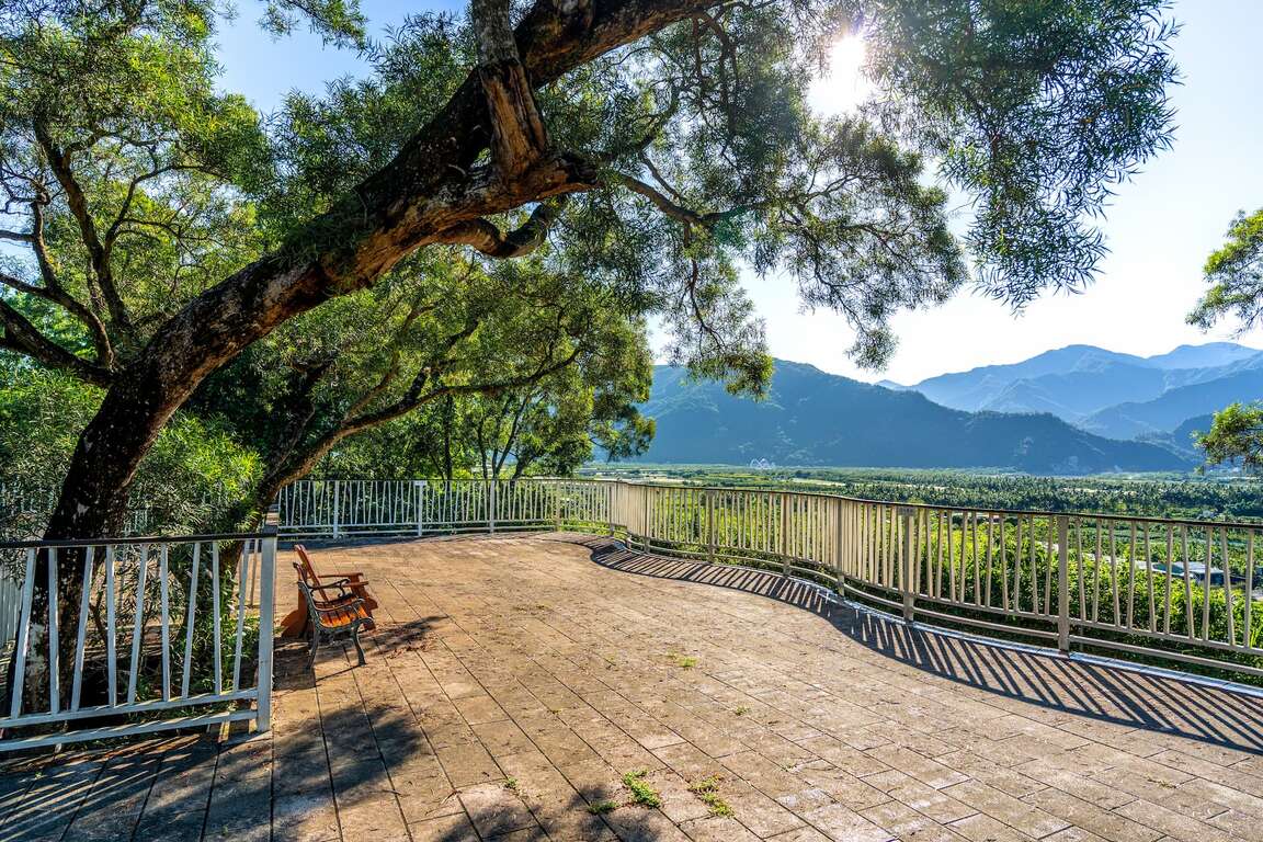
The Xinwei Forest Park sits on a tableland on the west bank of the Laonong River, around the 45km mark of the Provincial Highway No. 28. Since it is 200 meters above sea level, visitors can enjoy a bird’s-eye view of the Central Mountain Range and Laonong River below. 
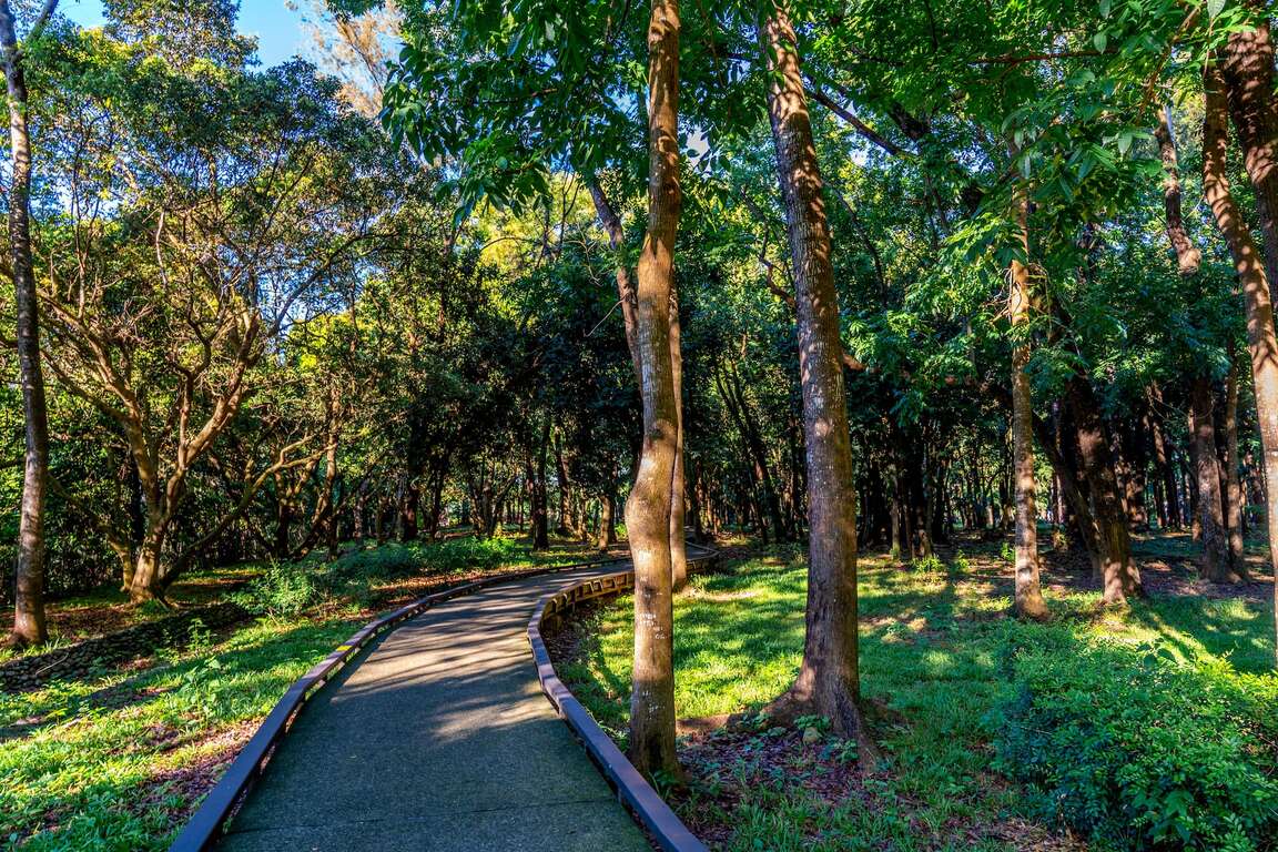
The forest park used to be the biggest seedling plantation in Taiwan and covered an area of about 29 hectares. It is now home to more than 200 kinds of seedlings, mostly tropical plants. Mahogany, bamboo, and Chinese fir seedlings are most commonly seen in the plantation.

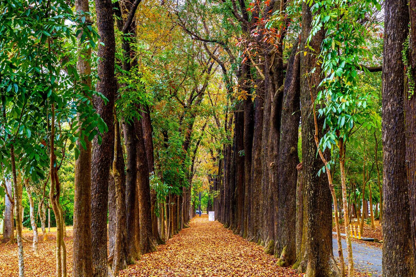
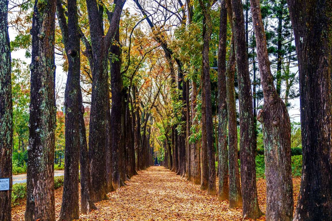
The whole park is covered in green during spring and summer, but between the end of winter and the beginning of spring, you will see a 2km long red-and-yellow corridor standing out, and that is the park’s famous Mahogany Avenue. During the transition between the two seasons, Mahogany trees lining the two sides of the avenue will turn red and yellow, creating an exotic view that attracts many couples to come for leisurely walks. The avenue is also a popular destination for taking wedding photos.

Visitors are recommended to spend an hour in the park, opening up their senses to experience the wonder of the forest. 

Xinwei Forest Park
4.4 4stars 535 reviews
TaiJuanderer
3stars 5 months ago

We did not get in park because it will close 5PM. We had just took picture at the the gate. Free parking area.

Jimmy Sun
5stars 9 months ago

So good

彭以馨
4stars a month ago

One house (stone house that is warm in winter and cool in summer), two springs (Lover Valley Hot Spring, Dona Hot Spring), three mountains (Longtou Mountain, Snakehead Mountain and Guixing Mountain), fourth place (world-class wintering type Purple Butterfly Valley), and five grains (Lover Valley, Youqing Valley, Meiya Valley, Eagle Canyon, Hongchen Canyon), showing the rich, colorful and magnificent natural ecological landscape and humanistic beauty of Maolin National Scenic Area. Located at the southern foot of the Central Mountain Range, the altitude ranges from 230 meters to 2,700 meters. The climate is a typical subtropical and temperate rainforest climate. The Zhuokou River winds through the area. The residents in the area are mainly Taiwanese aboriginal Rukai people. Mainly, but the Sanli language under its jurisdiction is different (Dona Thakongadavane, Wanshan 'Oponoho, Maolin Teldreka). With rich natural ecology, sightseeing resources and unique cultural characteristics, it was formally established as the Maolin National Scenic Area in December 2001, covering the main Maolin area (Taoyuan, Liugui, Maolin, Sandimen, Majia , Wutai) and other six townships in high-screen areas. Due to the obvious terrain, wide field of vision, and the traditional folk customs of the Rukai people, there are very rich natural landscape ecological resources, such as meandering streams, rock carvings, mountains, canyons, waterfalls, suspension bridges, hot springs, stone houses and mountain cultural relics, etc. , making the pristine Maolin gradually become the most popular tourist attraction and resort in southern Taiwan. The main scenic spots are Lover's Valley, Blue Water Lake in Maolin Valley, Youqing Valley, Meiya Valley, Longtou Mountain, Eagle Canyon, Dona Folk Village, Dona Hot Spring, Hot Spring Canyon, Hongchen Canyon, Dona Hidden Waterfall, Dona Rhododendron Valley and Ghost Ax Temple, etc. In addition to the mountain scenery of high mountains, it also creates special terrain and geology such as waterfalls, canyons, and rich animal and plant landscapes. Longtou Mountain and Snake Head Mountain are the circulation hills. The formation of the two mountains is different. The soil and rocks accumulated on the slippery ground are connected with the hills behind the snake head, forming today's landform that resembles a hundred-step snake head, and it is separated from Longtou Mountain on both sides to reflect each other. The separation of the dragon's head and the dragon's ridge seen in Longtoushan is the result of deliberately blasting to change the direction of the water flow during the Japanese occupation period to facilitate the transportation of local residents. This natural spectacle, which looks like a giant dragon spitting out beads, is caused by meandering currents and circulation mounds. Looking down from a height, it looks like a giant dragon entrenched in a valley, and the scenery is very spectacular. Longtou Mountain, Snakehead Mountain and Guixing Mountain are even more named together, becoming the three famous mountains in Maolin. In addition, there are hundreds of thousands of purple butterflies inhabiting the magnificent wonders of the valley, wandering among the ecological trails, and enjoying the world-class wintering butterfly valley wonders! You can also listen to the myths and legends of the Rukai tribe (indigenous people); appreciate the unique stone house architecture (warm in winter and cool in summer), exquisite traditional crafts; known as the highest and most spectacular suspension bridge in Southeast Asia, with a total length of 232 meters and a height of 103 meters (33 storeys high); and a variety of lively festivals, local traditional (roasted chicken) food, and the Sanhei characteristic industry that has been vigorously promoted in recent years, adding to the Maolin National Scenic Area, the richness of natural ecology and humanistic beauty Degree and colorful style~ It is worth inviting friends to come here to experience and play (at least arrange a one-day itinerary, so as not to feel too rushed, too rushed...).

馬淑錦
5stars 3 weeks ago

●Net zero green life promotion speech Xinwei Forest Park is located on the platform on the west bank of Laonong River, 45K, Provincial Highway 28, Provincial Highway 28, Liugui District. It is about 200 meters above sea level and overlooks the central mountain range and Laonong River. It was one of the largest nurseries in Taiwan in the early days, covering an area of ​​about 30 Jia, mainly to cultivate tropical forest seedlings, with more than 200 species of seedlings, among which mahogany, bamboo, and fir are the most. The whole area is full of greenery in spring and summer, and there is a mahogany avenue about 2 kilometers in the park. At the end of winter and the beginning of spring, the green leaves are red and yellow, and the rows of trees extend into a natural corridor. Couples come here for a walk, and it is a very popular spot for wedding photography.

wenwen C
5stars 4 months ago

●A total length of 2 kilometers ●Mahogany walkway deciduous rug ●Popular attractions for online wedding photography Located in Xinwei Forest Park in Liugui Township, 45km away from Taiwan Highway 28, there is a visitor center next to it. The most famous one is the mahogany trail. , Strolling in the park and breathing phytoncine, it is the deciduous period in late spring, there are beautiful brown fallen leaves everywhere, many tourists are smiling, while swaying the fallen leaves, while jumping and taking beautiful photos, it is very pleasant. Xinwei Forest Park was originally a part of the old riverbed of the Laonong River. Later, due to the excellent soil quality, it was built as a nursery and mainly planted saplings. There are more than 200 species of cultivated species. It attracts those who like to get close to nature and summer For summer vacationers, there are gazebos and beautiful forest boardwalks in the park, which are full of greenery on sunny days. You can see the sunlight refracting the ground from the gaps in the leaves. On rainy days, you can feel the misty mist and feel like a dream forest.

Last Update:2022-07-14

Sitemap
Unfold Menu
Close Menu
Nearby Travel Info